BETWEEN Brexit and almost 100 years of partition, we hear a lot about ‘north’ and ‘south’ in this part of the world. So much so it seems the border may be clouding our understanding of Irish geography.
While people here have long since spoke of going ‘down’ to Donegal for the day, many are well aware it is ‘up’ from Fermanagh, given that it is the most northerly county in the country.
Turns of phrase aside however, a lesser known fact about the location of Fermanagh has amazed many here in the Herald office.
Put simply, there are parts of Co Mayo that are further north than parts of Co Fermanagh, which you might say makes the likes of former Taoiseach, Enda Kenny (pictured), a ‘nordie’ of sorts!
This shocking truth was recently revealed by local Twitter user @PauricOh, who referred to it as a “bombshell”.
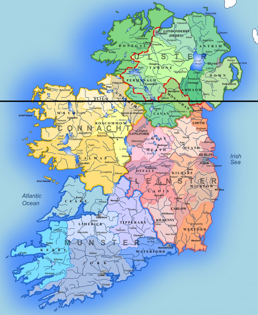
While it might be slightly unbelievable to many, the Herald can confirm that after close examination of a county map of Ireland, he is 100 percent correct. Draw a straight line across a map of Ireland and you will find the town of Ballina in the Connacht county is level with the south of Fermanagh.
Everything north of Ballina, including the whole northern coastline of Mayo, is then
either level or further north than many
parts of our own fair county.
So, if you are reading this in Derrylin, Newtownbutler, or Rosela, even Lisnaskea or Bellanaleck, you are currently further south than many parts of Mayo, a county that shares a border with Galway.
Even Enniskillen is around level with parts of Mayo.

Fermanagh is more southern than parts of Mayo!
Posted: 9:07 am January 24, 2020
Posted: 9:07 am January 24, 2020


